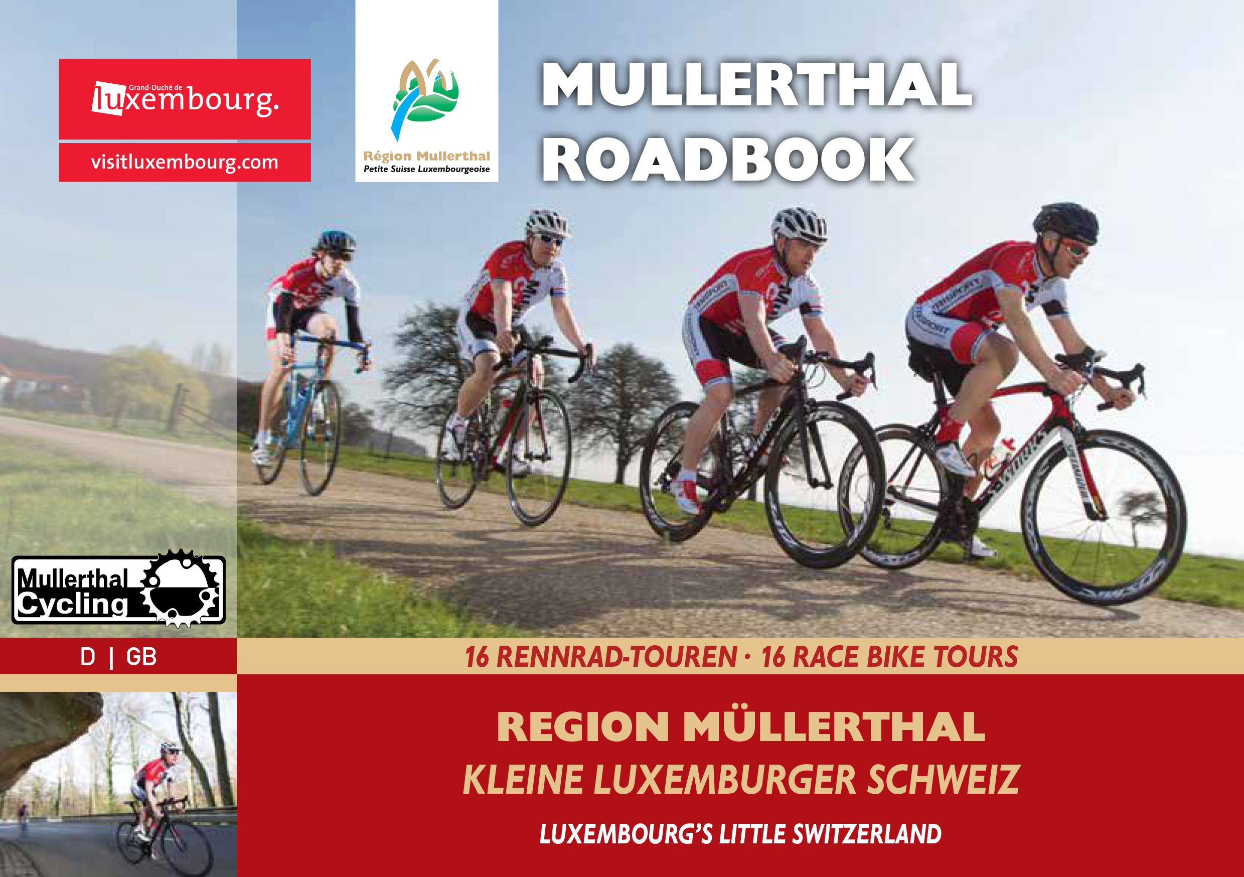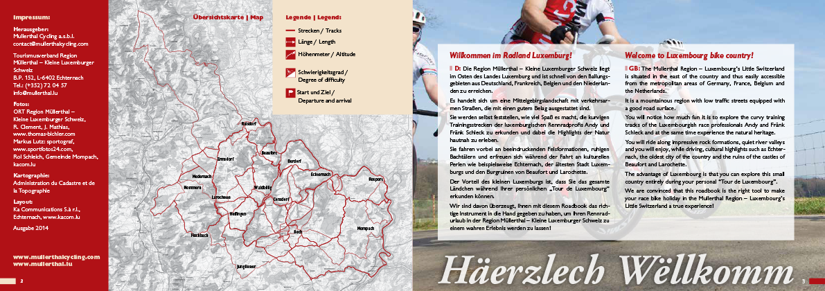
ROADMAPS
Welcome to the cycling country of Luxembourg!
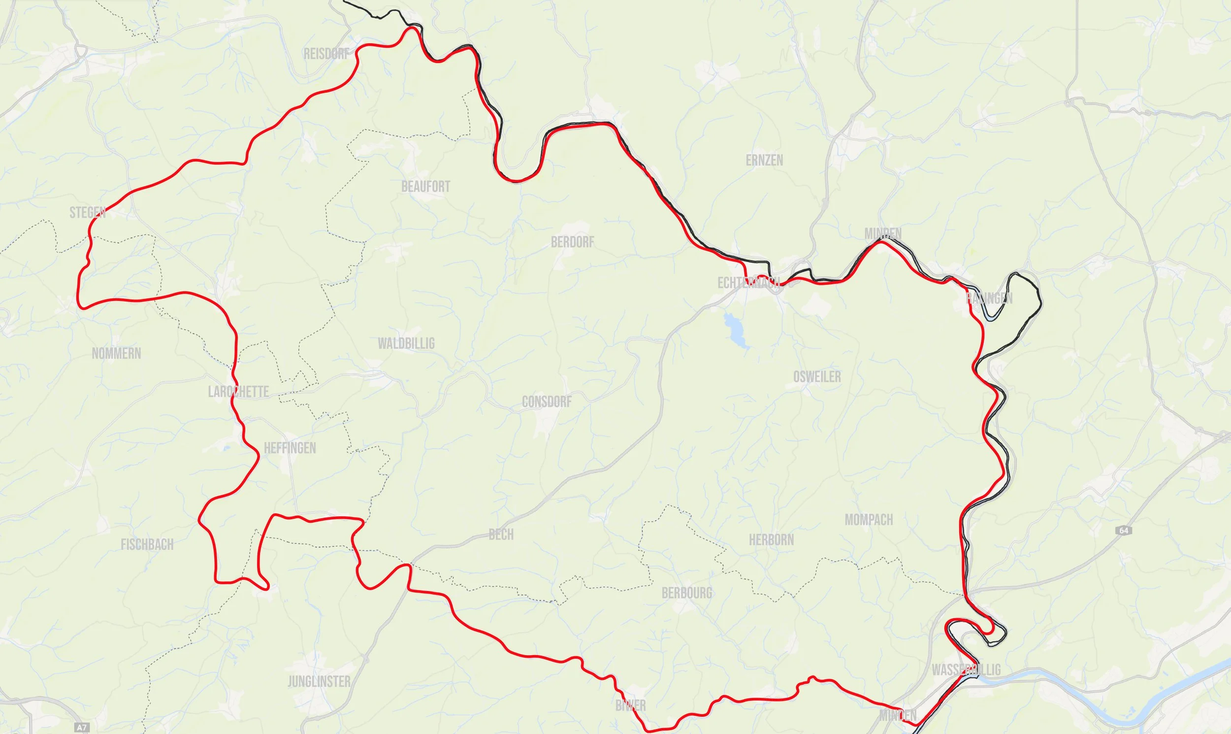
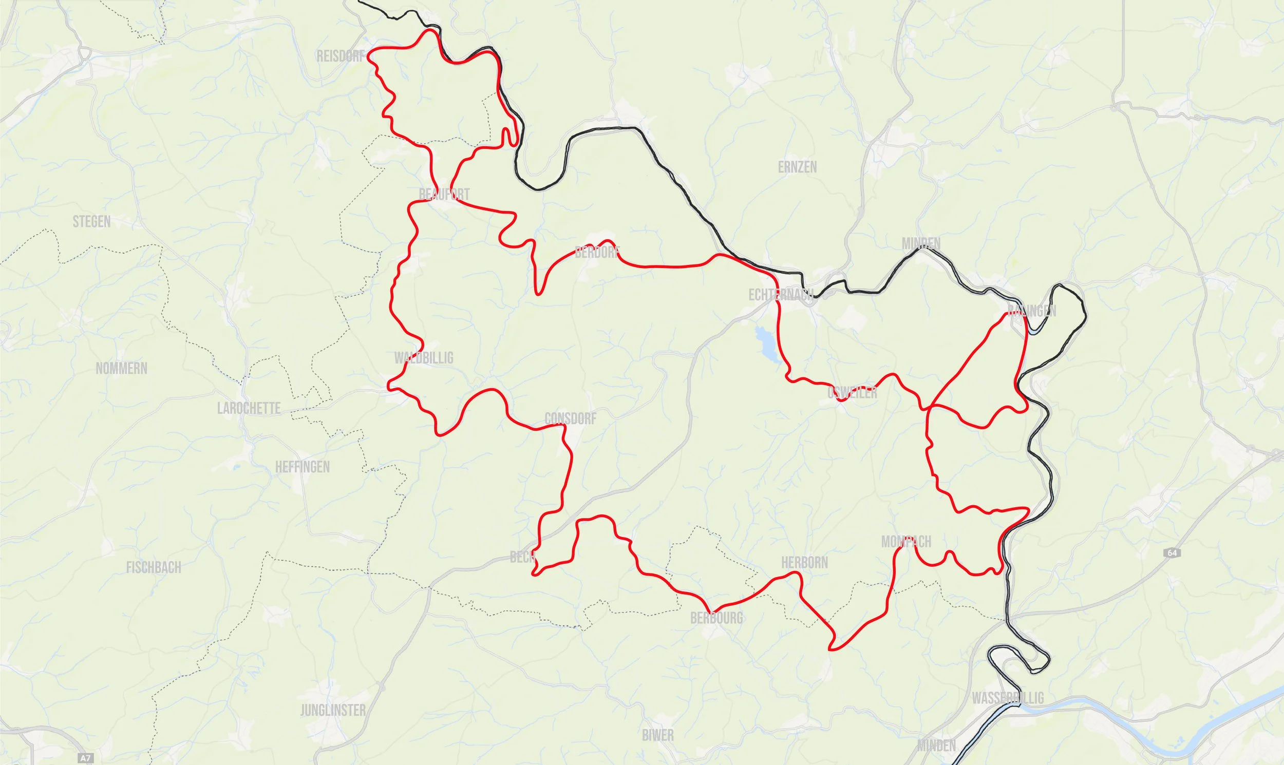
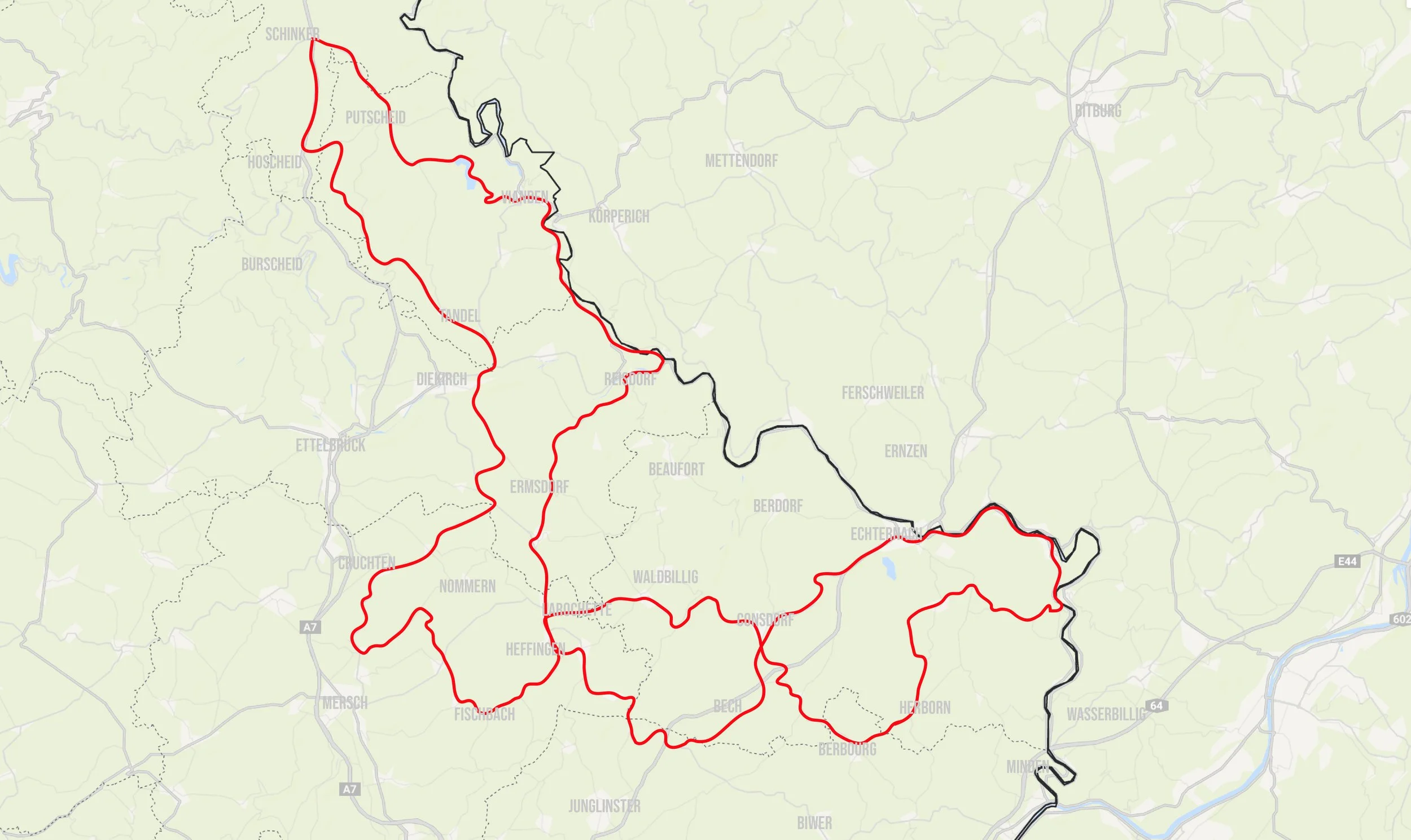
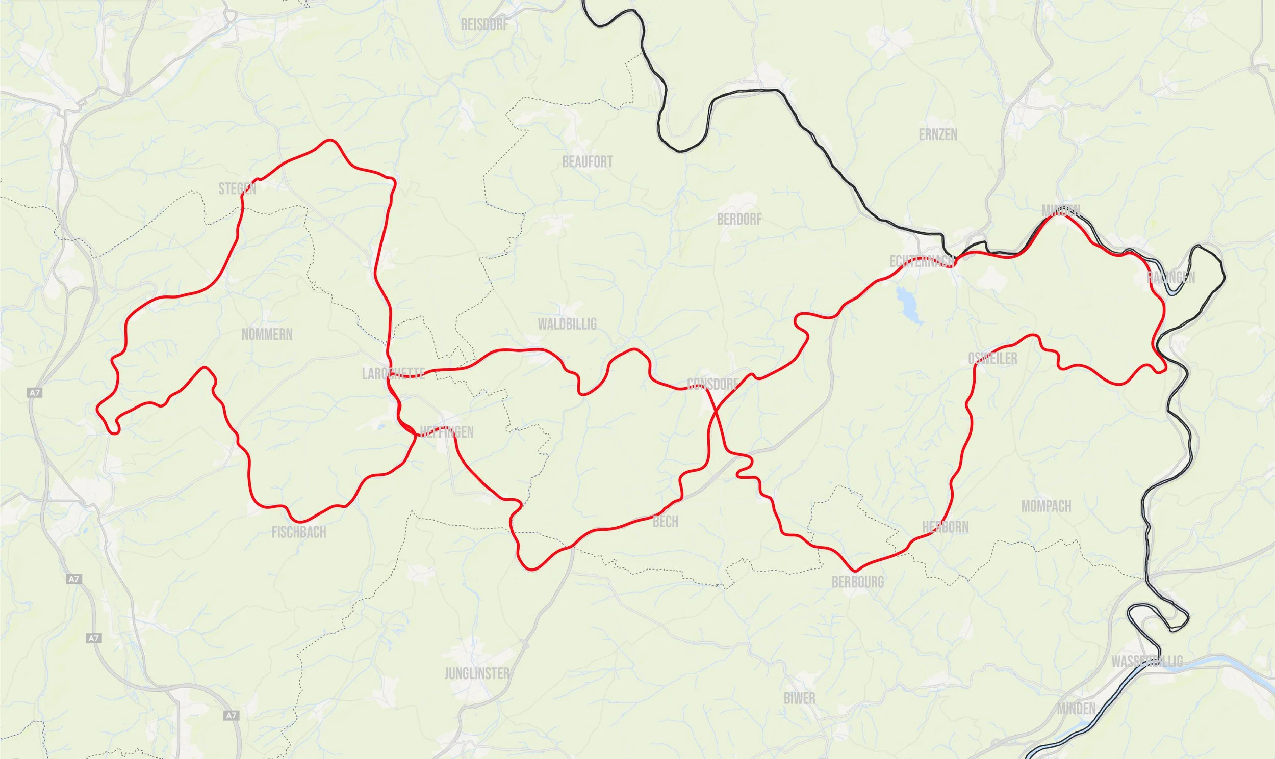
The Müllerthal region – Luxembourg’s Little Switzerland – is located in the east of the country and can be quickly reached from the conurbations of Germany, France, Belgium and the Netherlands.
It is a low mountain range landscape with low-traffic roads that are equipped with good road surfaces.
You will discover for yourself how much fun it is to explore the winding training routes of Luxembourg's professional racing cyclists and experience the highlights of nature up close.
You will pass impressive rock formations and tranquil stream valleys, and enjoy cultural gems such as Echternach, Luxembourg's oldest town, and the castle ruins of Beaufort and Larochette.
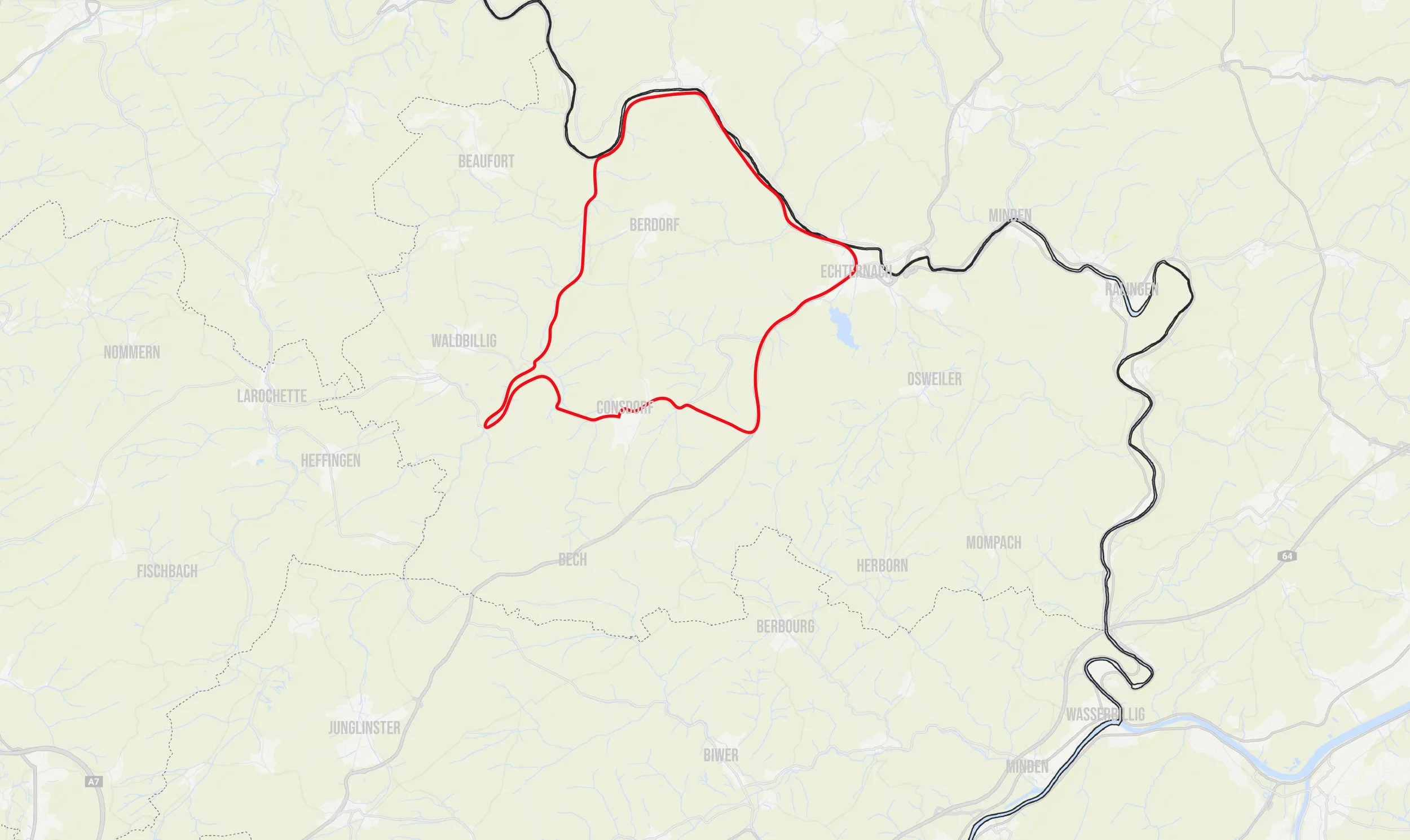
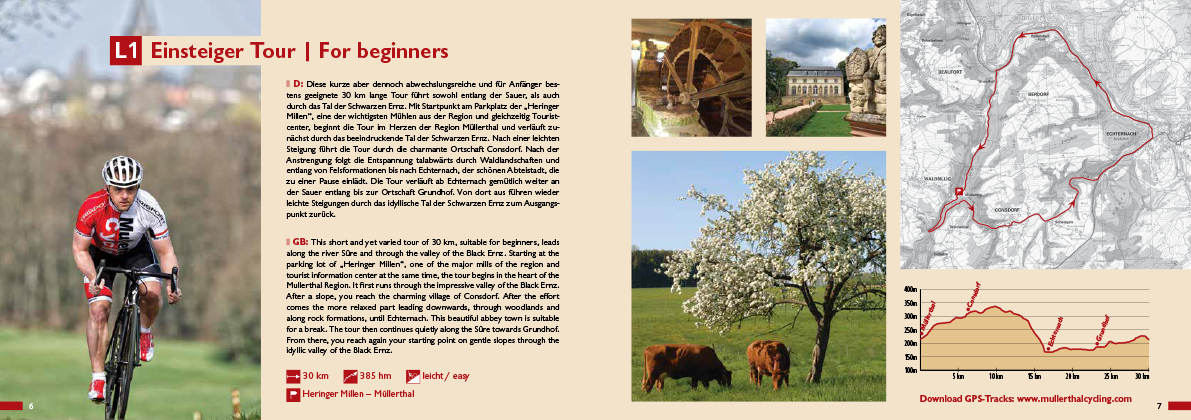
l1 BEGINNER tour
easy - 30 km - 385 Altitude

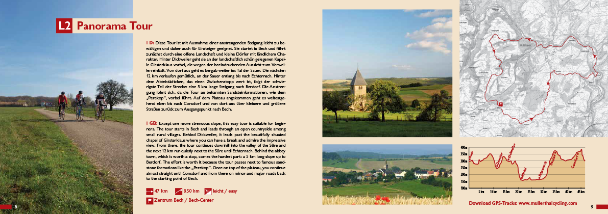
l2 Panorama Tour
easy - 47km - 850 Altitude
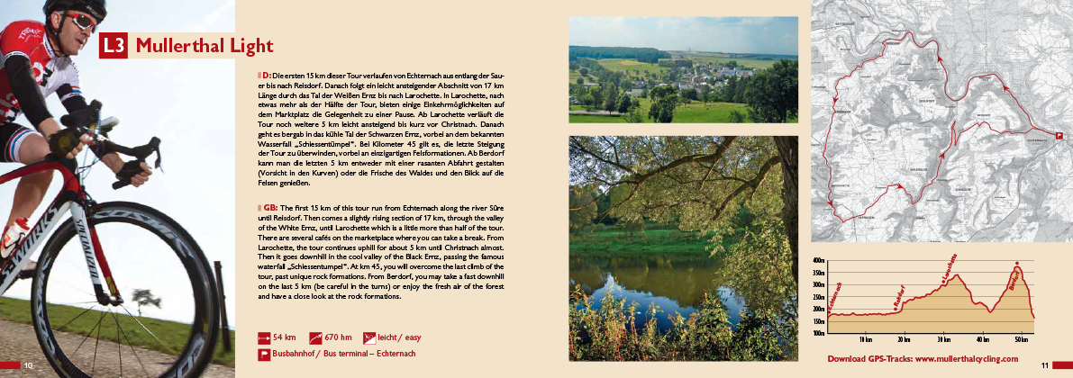
l3 Mullerthal light
easy - 54km - 670 Altitude

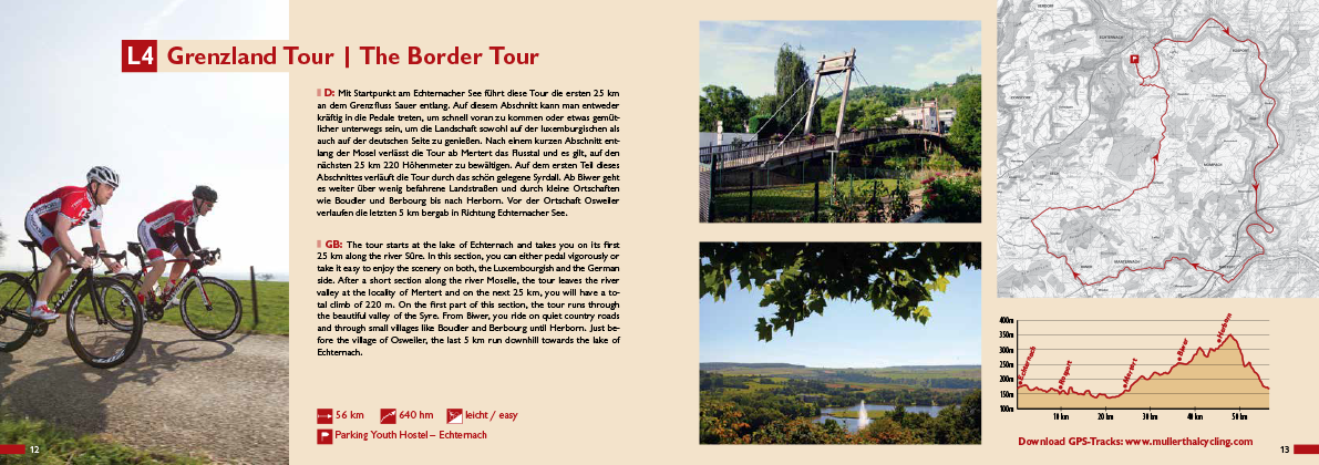
l4 border Tour
easy - 56km - 640 Altitude
l5 discovery tour
easy - 59km - 675 Altitude
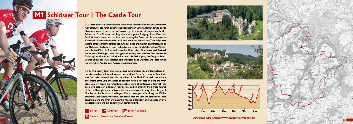
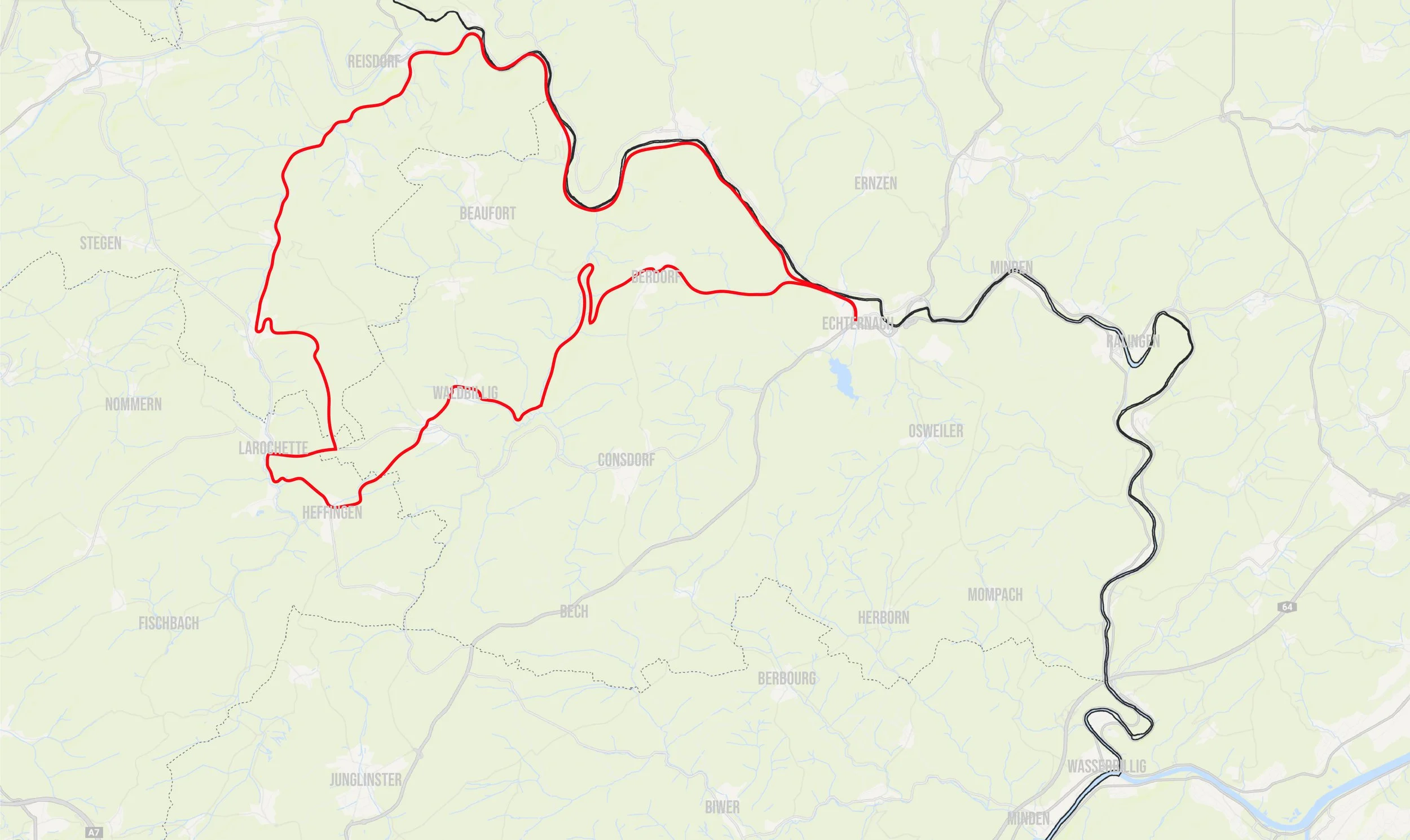
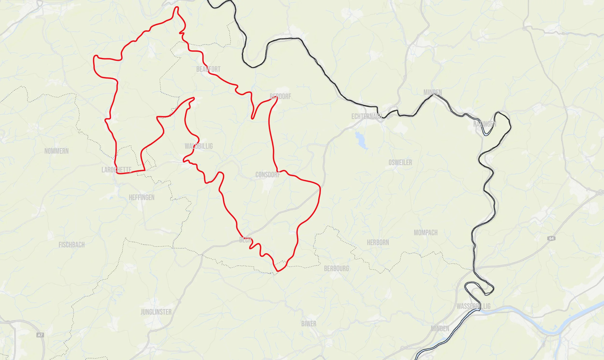
m1 castle Tour
average - 65km - 1.040 Altitude
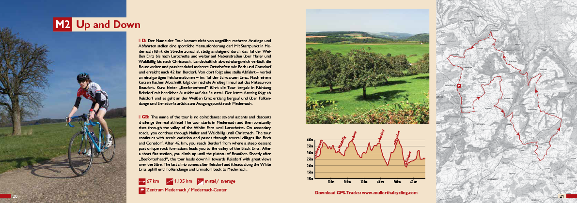
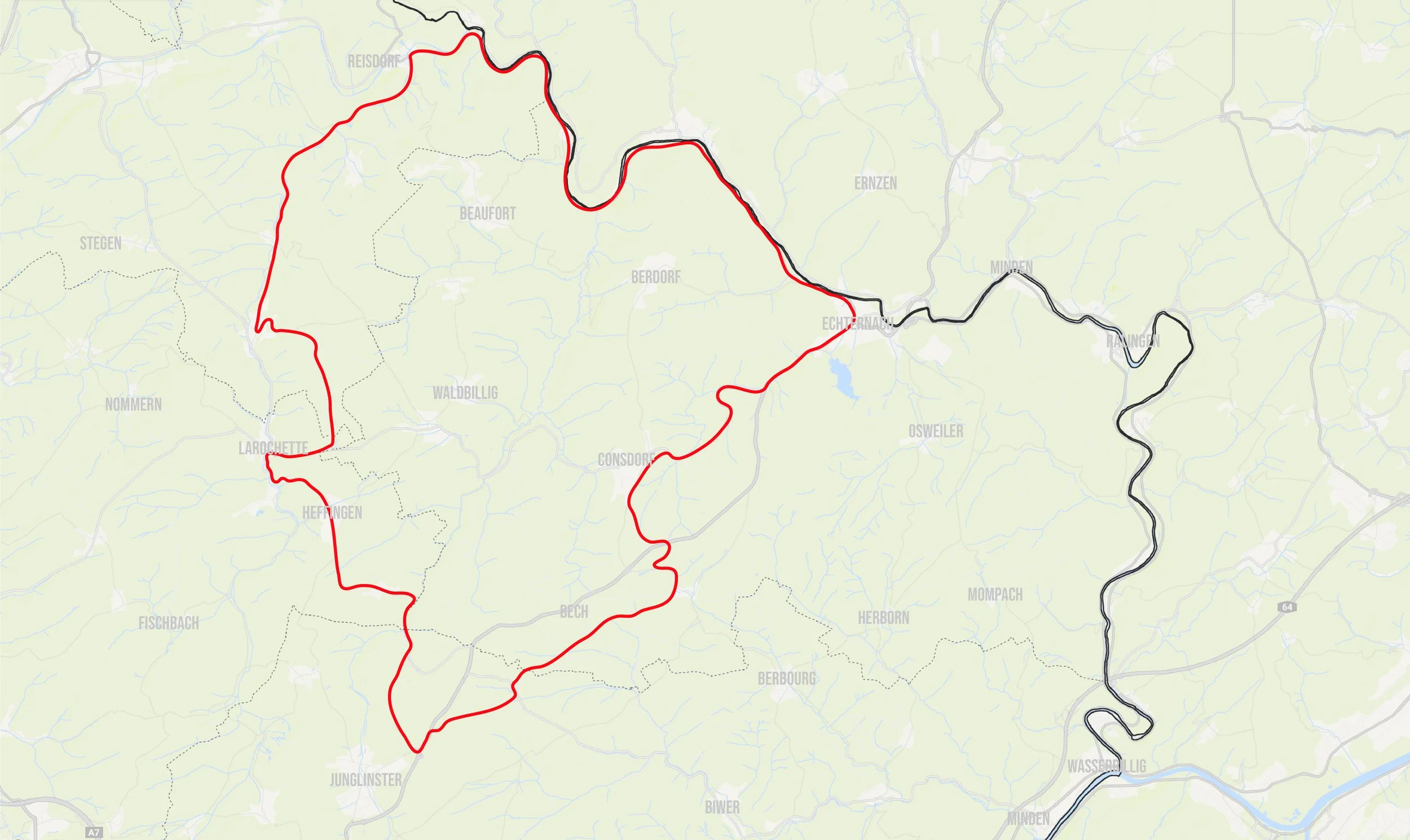
m2 up and down
average - 67km - 1.135 Altitude
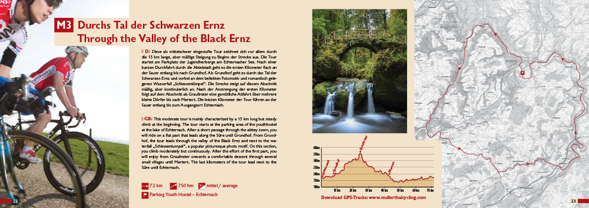
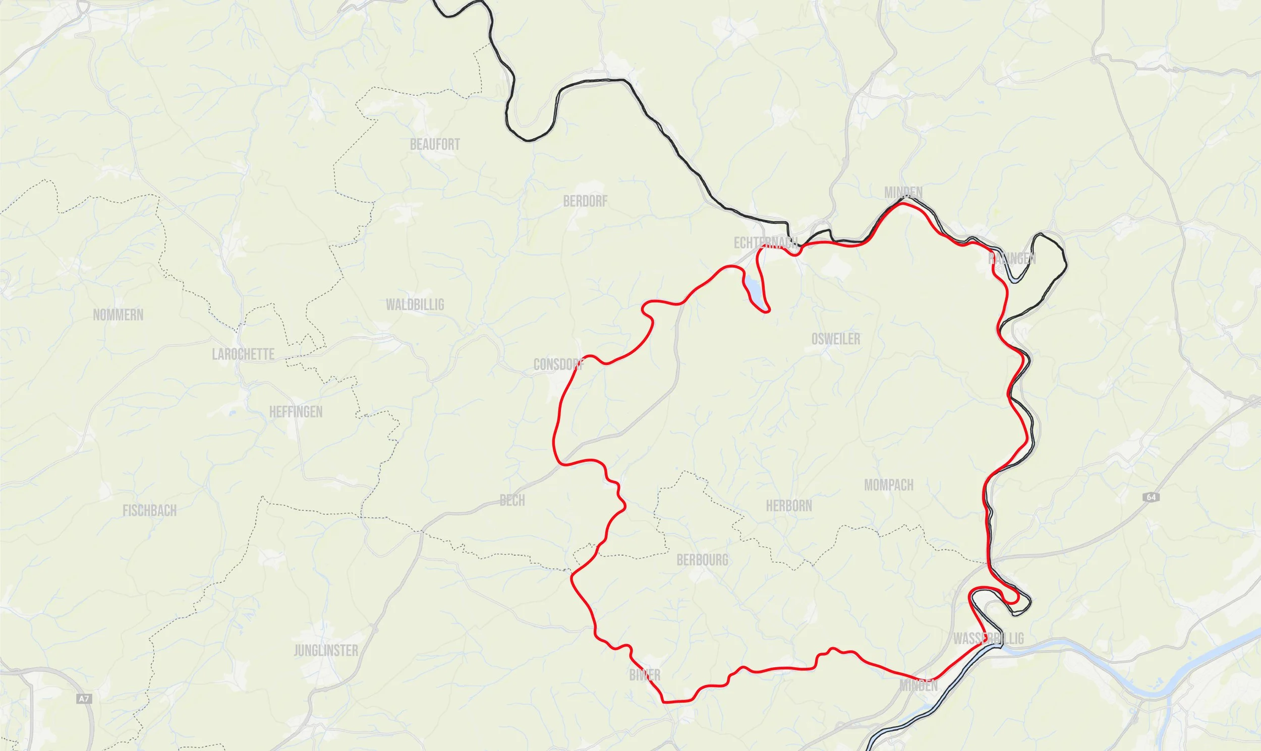
m3 the valley of the black ernz
average - 72km - 750 Altitude

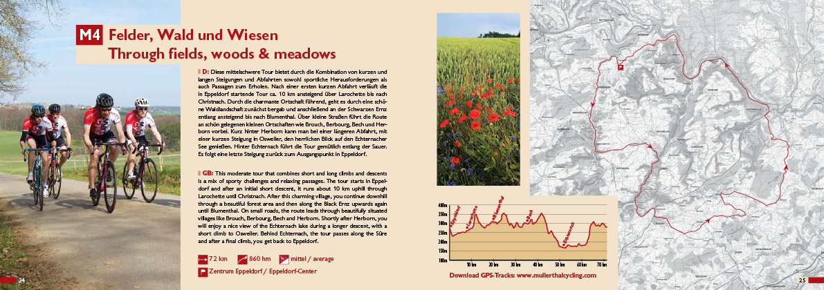
m4 fields, Woods and meadows
average - 72km - 860 Altitude

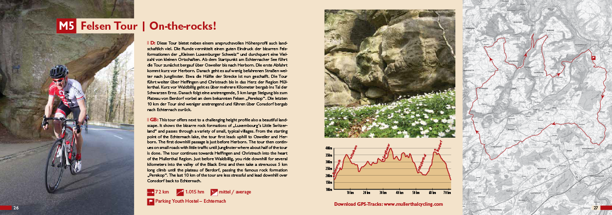
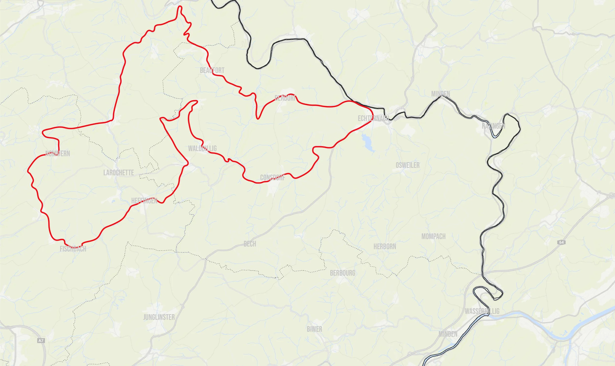
m5 on the rocks
average - 72km - 1.015 Altitude
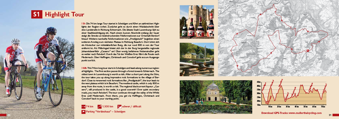
s1 highlight tour
difficult - 74km - 1.300 Altitude
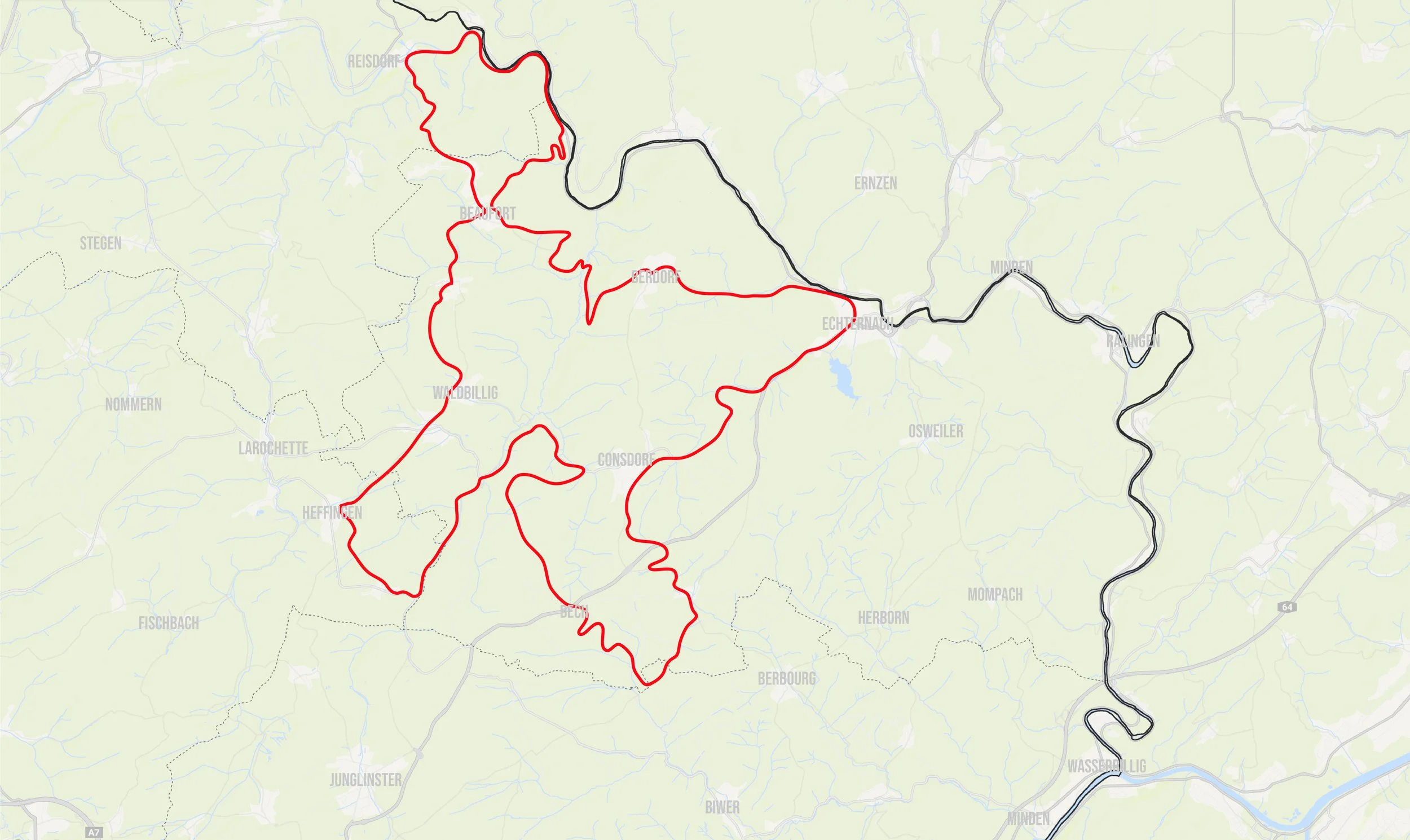
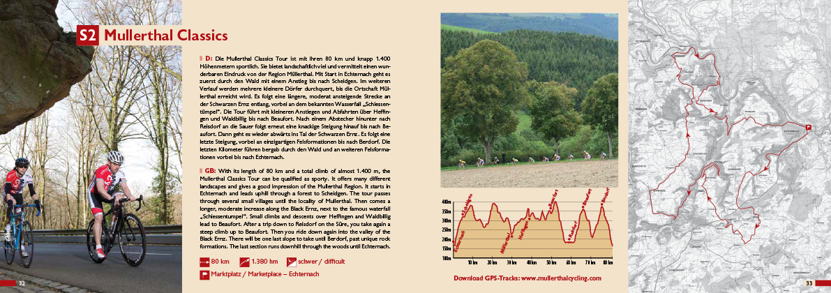
s2 mullerthal classics
difficult - 80km - 1.380 Altitude
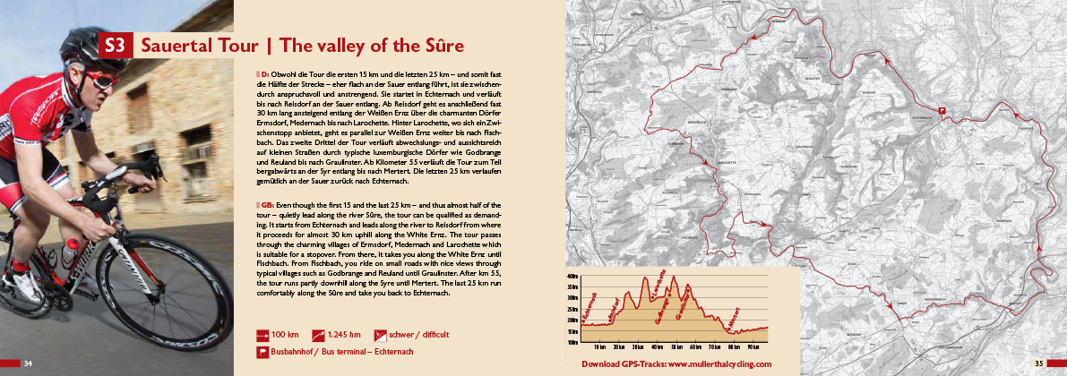
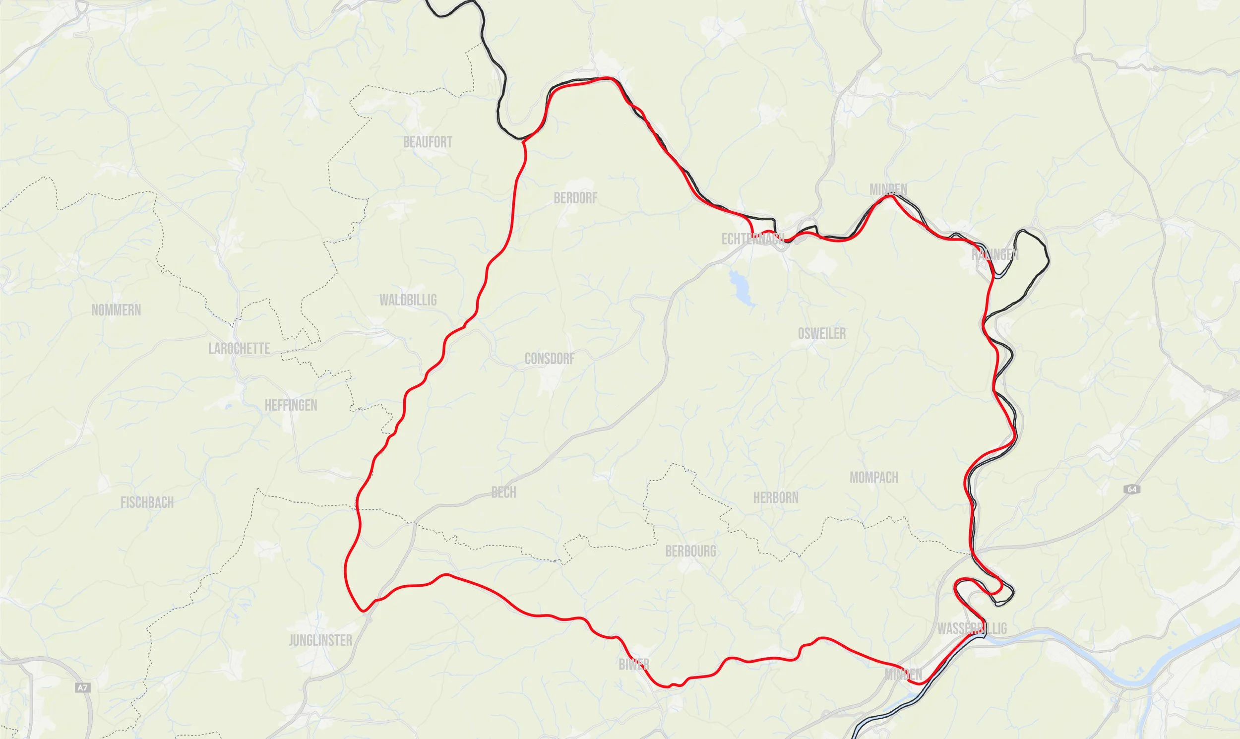
s3 sauertal tour
difficult - 100km - 1.245 Altitude
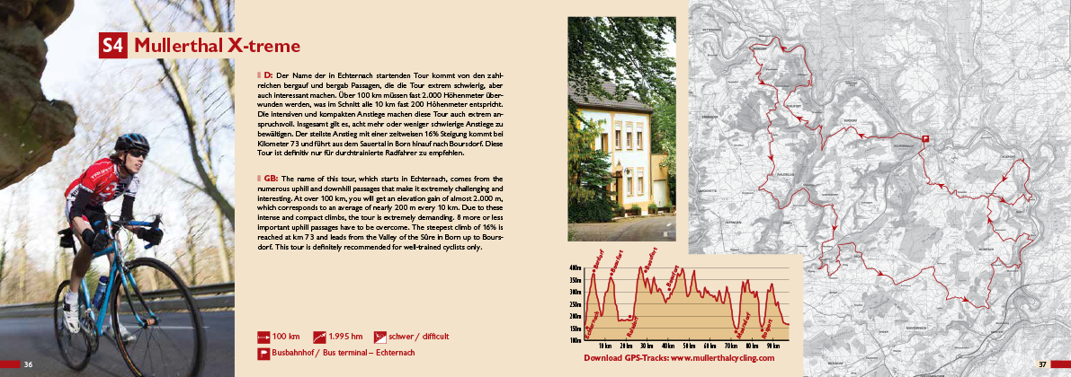
s4 mullerthal x-treme
difficult - 100km - 1.995 Altitude
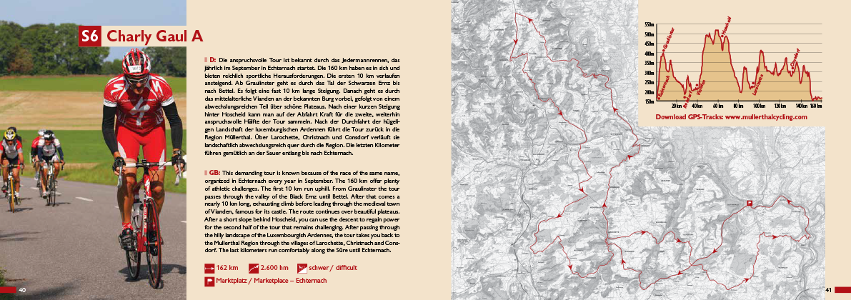
s5 charly gaul A
difficult - 162km - 2.600 Altitude
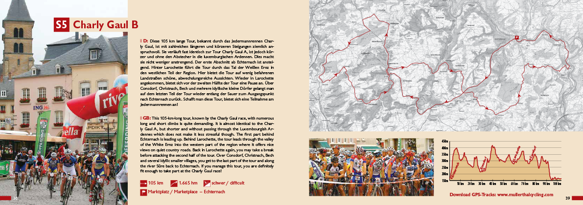
s6 charly gaul b
difficult - 105km - 1.665 Altitude